|
FURTHER UPDATE 11/27/22: Just to add that Sunday has seen temperatures mid to upper 40s with rain starting mid-afternoon. Whatever might have been skiable on Saturday isn't likely skiable now. The exception would be the man-made trails at Van Ho - at least for those who are looking for a good "vertical ascent" workout.
UPDATE 11/26/22: Continued warm weather since Thursday has shrunk any available skiing. Mt. Van Hoevenberg has at least 1.5 km of their "World Cup" trails open on man-made snow, although the full trail report shows the Flatlander network as still skaible - well maybe.... Paul Smith's VIC still has three trails totaling 4 km skiable, but that may not last through the day. Forecast is for more rain on Sunday afternoon and night. Cooler on Monday with maybe a bit of snow, but warm again on Wednesday with more rain possible. Oh well, nice while it lasted. Next report likely not until we see some useful improvement. INTRODUCTION Given the forecast for warmer conditions through the weekend, conditions will be changing - sometimes rapidly - but not likely for the better. While the higher summits will see some more snow, the forecast for the lower elevations calls for temperatures in the low 40s Thursday through Sunday with at least light rain on Friday and Sunday. The temperatures will again drop starting on Monday, but too late to "salvage" the weekend. JACKRABBIT TRAIL Still very thin cover, but section from River Road to the Lake Placid Club Golf Course is skiable as is the Peninsula section - except for the first few hills in from Simply Gourmet/Dack Shack. The good news going forward is that a collective effort by BETA and several adjoining landowners has solved the landowner problem on the connection between Craig Wood Golf Course and ADK's Cascade Welcome Center. CROSS-COUNTRY SKI CENTERS ADK'S CASCADE WELCOME CENTER: Km Open and Groomed: 5 Track Set: 0 New snow: Base Depth: 2-3" Off Track 3-4" New Snow last 72 hours: 1" Surface Conditions: packed powder Remarks: Working to improve their base, but now open on a few trails. Remember, Cascade is now owned by the Adirondack Mt. Club. Ski shop open as usual, and ADK members will ski free once their trails are open. MOUNT VAN HOEVENBERG: Km Open and Groomed: 7 Track Set: 2 New snow: Base Depth: 2" Off track: 3-4" New snow past 72 hours: 1" Surface Conditions: packed powder Remarks: Officially open on 5 km of the flattest terrain plus 2 km of the "world cup" trails, which are also track-set. Other terrain is skiable but rough. PAUL SMITH'S VISITOR INTERPRETIVE CENTER: Km Open: Approximately 15 Track set: New Snow: Base Depth: 3-4" Off track: 4-5" New snow past 72 hours: 1" Surface Conditions: packed powder Remarks: Working on packing to improve the base, but most of the gentler terrain is skiable. DEWEY MOUNTAIN: Km Open: Track set: New Snow: Base Depth: 2-3" Off track: 3-4" New snow past 72 hours: 1" Surface Conditions: Remarks: Some trails have been rolled, but not officially open yet. TUPPER LAKE X-C SKI TRAILS Km Open: Approximately Track set: New Snow: Base Depth: Off track: New snow past 72 hours: Surface Conditions: packed powder Remarks: Their Facebook page didn't provide any specifics for snow depth, but the photos make these free, groomed trails appear to be the best skiing available. The report does note that the snow will be sticky as conditions warm, but there is Maxiglide in the sign-in box. BACKCOUNTRY CONDITIONS: Snow depth at Lake Colden: 5" 8-12" above 4,000 feet Given the snow on the higher summits, skis or snowshoes are now required above 4,000 ft. by regulation in the High Peaks. Good traction is essential for most any trails to even the lower summits. WRIGHT PEAK SKI TRAIL: No skiing yet. MARCY TRAIL: Not yet skiable. WHITEFACE HIGHWAY: Cover all the way from the Toll House to the Castle. 2-3" at the Toll House, 6-8" at the top. A few short stretches have less cover due to wind on Wednesday, but every stretch is covered edge to edge MARCY DAM TRUCK TRAIL: Just barely skiable. Winter barriers not up as of Thursday, 11/17, so some vehicular traffic on the first mile. HIKING TRAIL FROM ADK LOJ: Not skiable AVALANCHE PASS: Not skiable CONNERY POND TO WHITEFACE LANDING: Not skiable HAYS BROOK TRUCK TRAIL: Just barely skiable to both Grass Pond and the Sheep Meadow. Too little snow to gauge whether the winter plowing of last year will continue. FISH POND TRUCK TRAIL: Probably skiable up to the first big climb, but, not reports. RAQUETTE FALLS: Not skiable GULF BROOK ROAD TO BOREAS PONDS: Gate is closed, but there is still some vehicular traffic. Perhaps doable on skis, but not recommended. NEWCOMB LAKE ROAD TO CAMP SANTANONI: 2-3" of dense snow is all it takes to make this classic ski skiable. Some thinner spots, but they are easily avoidable. Considerable foot traffic as far as the Moose Pond junction, but a skied-in track for much of that distance on the edges. Just ski tracks and very nice skiing from there to Newcomb Lake. AUSABLE LAKE ROAD: Skiable, but very thin for the first 1/2 mile. Some ski tracks.
0 Comments
INTRODUCTION
UPDATE 11/20: Another few inches of light snow on Saturday night and conditions are further improved. Mt. Van Hoevenberg is now open on 5 km of the flatter terrain, starting from the old biathlon range. "World Cup" trails closed for snowmaking with an 11/23 opening planned. For now, the report says, "...rock skis recommended." Also Paul Smith's VIC is now open for skiing on a few trails. JACKRABBIT TRAIL No section quite ready to ski just yet CROSS-COUNTRY SKI CENTERS CASCADE X-C SKI CENTER: Km Open and Groomed: Track Set: New snow: Base Depth: Off Track Surface Conditions: Remarks: Working to improve their base, but not open just yet. Remember, Cascade is now owned by the Adirondack Mt. Club. Ski shop open as usual, and ADK members will ski free once their trails are open. MOUNT VAN HOEVENBERG: Km Open and Groomed: 5 Track Set: New snow: 2" Base Depth: 3" Surface Conditions: packed powder Remarks: See above. PAUL SMITHS VISITOR INTERPRETIVE CENTER: Km Open: Track set: New Snow: Base Depth: Surface Conditions: Remarks: Working on packing to improve the base, with some trails skiable. BACKCOUNTRY CONDITIONS: No report at Lake Colden (estimate) 8-10" above 4,000 feet Skis or snowshoes not yet required required by regulation in the High Peaks, but good traction is essential for any of the higher summits. WRIGHT PEAK SKI TRAIL: No skiing yet. MARCY TRAIL: Not yet skiable. WHITEFACE HIGHWAY: Cover all the way from the Toll House to the Castle. 2-3" at the Toll House, 6-8" at the top. A few short stretches have less cover due to wind on Wednesday, but every stretch is covered edge to edge MARCY DAM TRUCK TRAIL: Just barely skiable. Winter barriers not up as of Thursday, 17/11, so some vehicular traffic on the first mile. HIKING TRAIL FROM ADK LOJ: Not skiable AVALANCHE PASS: Not skiable CONNERY POND TO WHITEFACE LANDING: Not skiable HAYS BROOK TRUCK TRAIL: Just barely skiable to both Grass Pond and the Sheep Meadow. Too little snow to gauge whether the winter plowing of last year will continue. FISH POND TRUCK TRAIL: Probably skiable up to the first big climb, but, not reports. RAQUETTE FALLS: Not skiable GULF BROOK ROAD TO BOREAS PONDS: Gate is closed, but there is still some vehicular traffic. Perhaps doable on skis, but not recommended. NEWCOMB LAKE ROAD TO CAMP SANTANONI: 2-3" of dense snow is all it takes to make this classic ski skiable. Some thinner spots, but they are easily avoidable. Considerable foot traffic as far as the Moose Pond junction, but a skied-in track for much of that distance on the edges. Just ski tracks and very nice skiing from there to Newcomb Lake. AUSABLE LAKE ROAD: Skiable, but very thin for the first 1/2 mile. No ski tracks, just boot tracks; but there is room for ski tracks in the center. After yesterday's 2-3" of wet snow, we've picked up an inch or so of new snow with intermittent snow squalls continuing as of 4 PM. The wet snow, now mostly frozen has made about as good a base as can be made with 2" of snow with the result that the Whiteface Highway is in very good shape with some other possibilities at least barely skiable. Continued cold through the weekend and into next week so what we have is going to stay. Some serious lake effect snow predicted for areas to the west, but if you live near there you've surely heard about that by now.
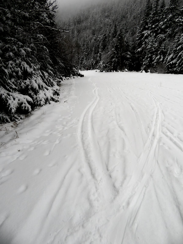
Meantime, Whiteface Highway was apparently quite busy yesterday with one report saying there were 30 vehicles parked there at one point. Only ten or so today, but still quite a number for a weekday. The Highway is skiable all the way to the Castle, and even the Wilmington Turn is covered. Some sections below the pump house are thin with just what has fallen since yesterday, but the coverage is edge to edge and no problem breaking through to the pavement. A bit of additional checking has determined that the Hays Brook Truck Trail has enough snow to be just barely skiable, but no ski tracks so far. Likewise, Meadows Lane to South Meadow and the Marcy Dam Truck Trail has enough snow to be just barely skiable. The barriers have yet to be put in place and there has been some vehicular traffic without interfering with a possible ski. Given these condition on the north side of the High Peaks, it is not unreasonable to expect that Newcomb Lake Road to Camp Santanoni is also skiable, but no current report from there. AND THIS JUST IN: :Some of the Loggers Loop at the Paul Smith's VIC is skiable. Other trails have been rolled, which will set up a good base (and help freeze the ground) for any future snow. Additionally, golf courses are reported as good skiing as well. As Jackrabbit Johannsen famously said, time to "Ski, Ski, Ski." Photo of the Whiteface Highway on 11/17. Some good snow and even a few turns on the stretch just above the pump house. As predicted, we have picked up 2-4" of wet snow overnight with snow still falling as of 9 AM. There is a chance that the snow will change to rain in the valleys this afternoon, but higher up it should remain as snow. The snow falls on unfrozen ground, so there will be melting - both from above and below. Golf courses will have enough snow to ski, but skis may "clump up" given the unfrozen ground. Tomorrow we'll check out the Whiteface Highway, which should be good and remain so through the weekend as high temperatures, even in the valleys, are not expected to be much above freezing. And still no warming trend in sight into next week.
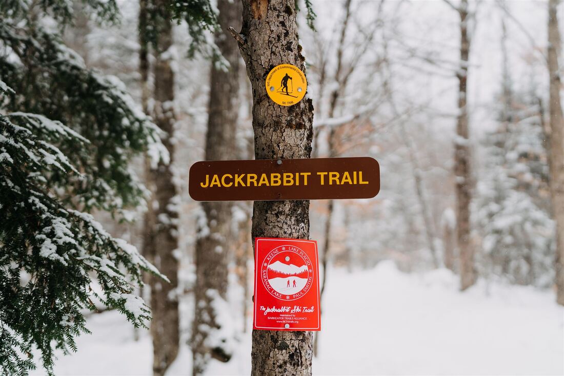
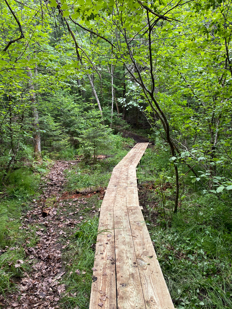
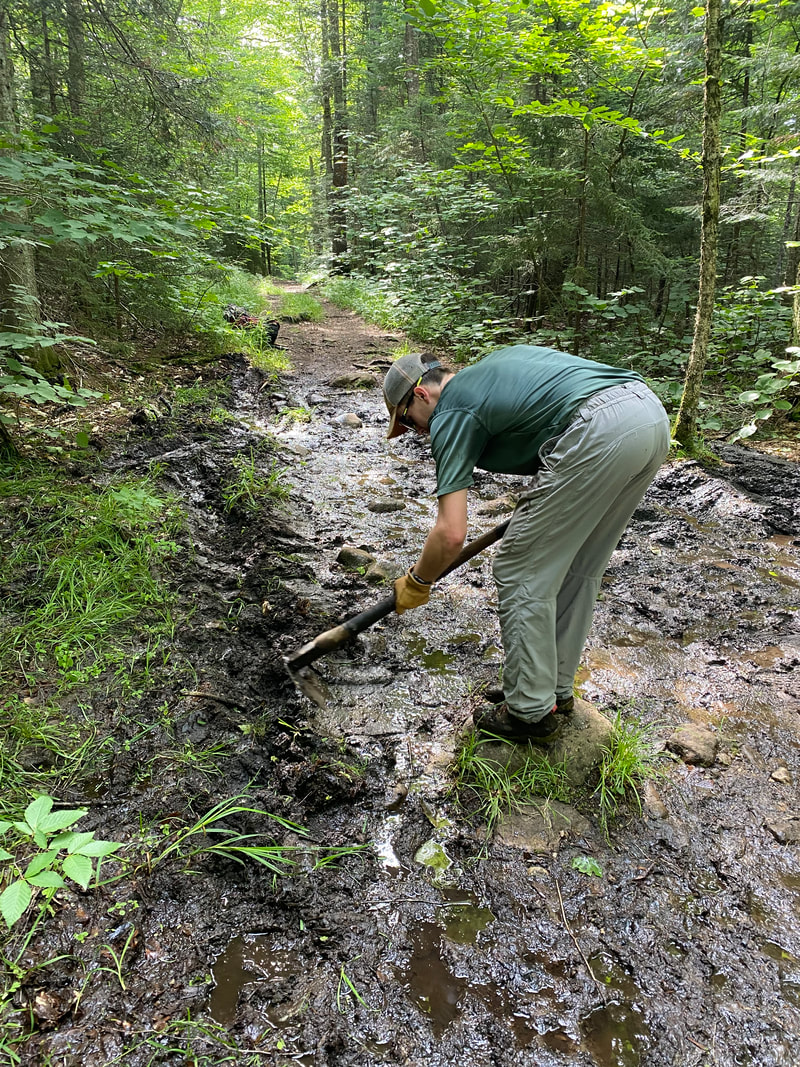
For those still contemplating a hike in the higher terrain, there is considerable ice to deal with. Traction aids definitely required with full-on winter conditions on any of the higher, exposed summits. Snowshoes still not required, but they could be useful above 3,500 feet. Tomorrow, we'll know more about the final accumulation above 3,500 feet as surely some over-achievers will ski to the top of the Whiteface Highway. We interrupt the usual ski conditions report to share an important update on the Jackrabbit Ski Trail. 37 Year History This coming year marks the 37th anniversary of the founding of the Jackrabbit Ski Trail, and the founding of our parent organization - the Adirondack Ski Touring Council. ASTC was formed in 1986 by local skiers who saw an opportunity to link up traditional ski routes and create a trail system that took people from town-to-town or at least from the towns out into the backcountry. ASTC’s first project was construction of the Jackrabbit Trail, which, it was hoped, would link Keene, Lake Placid, Saranac Lake, and Tupper Lake. Much of the construction and marking of the original 25-mile route between Keene and Saranac Lake occurred in the first two years from 1986 to 1988, including the re-opening of the Old Mountain Road and McKenzie Pass sections, which had been more or less abandoned up to this point. While the plan to reach Tupper Lake was ultimately scrapped and replaced with a connection from Saranac Lake to the VIC trail system in Paul Smiths, the overall goal of the trail was realized in short order, and today the Jackrabbit is recognized as one of the classic ski tours of the Adirondacks. The Jackrabbit is located on state Forest Preserve lands, conservation easement lands, North Elba Parks District lands, and about a dozen privately-owned parcels. While the route was originally conceived for winter use by skiers and as a Scandanavian-style “town to town” ski route. Over time much of the winter use has become concentrated in the more contiguous sections like Old Mountain Road and McKenzie Pass, while the sections in between are used more by “thru skiers” looking to make longer trips along the route. In the past 15 years, certain sections have become more popular for summer use by mountain bikers and hikers. For almost four decades, our organization and a veritable army of passionate volunteers has worked to preserve access to the various sections of the Jackrabbit and to maintain the trail at a high standard for the benefit of community residents and visitors. We have made some improvements and also experienced a few setbacks over the past couple of years, and felt it was a good time for a holistic update on the “state of the Jackrabbit.” Paul Smiths to NCCC Beginning at the VIC or the Red Dot trail in Paul Smiths, the trail traverses some beautiful terrain between Osgood and Church ponds, passes through a handful of Paul Smith’s College forestry plots, a small section of state lands, and then logging roads and a powerline on the 9-mile route to Lake Clear. Over the past couple of years BETA has updated signage along this “least known” section, installed new bog bridging, and worked with the college to accommodate timber harvesting operations that temporarily impacted trail access. Skiers heading south from Lake Clear to Saranac Lake must follow the former Remsen Lake Placid Railroad corridor, which is now being converted to the Adirondack Rail Trail. The railroad tracks and ties were removed from the corridor in 2020 to prepare for rail trail construction, which made it easier for local snowmobile clubs to groom the corridor, which in turn dramatically improved the skiing on this otherwise uneventful (but pretty) 6-mile section of the route. NYSDEC officially broke ground on the Rail Trail in November, 2022. Some sections of the rail trail will be temporarily closed until December 19, which will only affect the early ski season. NCCC to McKenzie Pond Road In case you’re not up to speed on our local acronyms, NCCC is North Country Community College, which is the start/end point of the original 25-mile Jackrabbit route. From here skiers follow the rail trail for another 0.5 mile before turning into a beautiful plantation pine forest and following an old snowmobile trail to McKenzie Pond Road. This area of state land is commonly referred to as Fowler’s Crossing and is part of the Saranac Lakes Wild Forest. This year the BETA trail crew added about 100 feet of new bog bridging to this section to make the trail more sustainable for year-round use and protect sensitive wetland habitat. These projects were funded by a grant from the North Elba LEAF program. Side note - BETA began work on a new system of singletrack trails in this parcel in 2019, but work was stalled by the Protect the Adirondacks! v. NYSDEC court decision that year (and the subsequent final decision in 2021). McKenzie Pond Road to Whiteface Inn Lane Some might say this is the best section of the whole trail, but we’ll leave it up to you to decide. From McKenzie Pond Road, the trail re-enters the forest at a parking lot where BETA has installed a new information kiosk about the Jackrabbit with beautiful cartography work by Adirondack Research. The first section leads to McKenzie Pond and is popular year-round with locals and visitors, many of whom probably are not aware that the first 0.5 mile between the road and the McKenzie Mountain Wilderness boundary is owned by the Black Fly Softball League, and public access (and parking) is only possible thanks to a permanent easement purchased by our organization in 2010. In 2022 BETA installed additional bog bridging on both sides of the state boundary to better accommodate the steady stream of hiker traffic in the summer months (no mountain biking is permitted on this section). This work, along with the new kiosk, was also funded by the North Elba LEAF program. Two miles in from the road the trail splits with the spur to the pond heading left, and to the right the infamous climb to the top of “McKenzie Pass” begins. Skied in the opposite direction, this is one of the finest cross country ski descents in the Adirondacks. From the top of the pass to the intersection with Whiteface Inn Lane the route follows a trail corridor that has been used by skiers for at least a century. Just before beginning the final descent to the road, the trail traverses a private inholding for about 0.5 mile before re-entering state land. This property changed hands in 2016 and BETA has worked tirelessly with the new owner to preserve public access for the trail. Additional “winter trail etiquette” signage has been installed and the DEC marked the trail “for skiing only” for the winter months, both attempts to dissuade the dreaded “postholers" which seems to worked for the most part. In 2021 and 2022, the Trail Crew and volunteers have put considerable effort into repairing drainage ditches and addressing persistently muddy areas on McKenzie Pass that have grown worse with an explosion in hiker traffic on this section. It seems that with Google searches and online maps like AllTrails, the word is out that this is an easier approach to the summits of McKenzie and Haystack mountains. On a random weekday this past July, we counted almost 40 cars parked along Whiteface Inn Lane. Whiteface Inn Lane to Mirror Lake/Lake Placid Club The original Jackrabbit route connected between Whiteface Inn Lane and the Brewster Peninsula Trails by crossing a marked route on the Whiteface Club Golf Course and Nordic Center. However, a reminder that as of December 1, 2020, the Whiteface Club is no longer permitting Jackrabbit Trail skiers to cross the golf course to make this connection. Thru-skiers must walk or ski (if conditions permit) on the road through the Whiteface Club property. If you wish to use the Whiteface Club Nordic center trails, day and season passes can be purchased at the club house. If you’re a member of the Whiteface Club and you happen to be reading this, we’d love your help in making a plea to the Club management to reverse this policy. In the meantime, we’re asking skiers to abide by the new access rule so that we don’t lose the connection entirely. Once past the golf course, the trail again traverses several parcels of private land before reaching the Peninsula trails and the trailhead on Saranac Avenue adjacent to Simply Gourmet. Side note - this makes for an excellent lunch stop when skiing the trail, and there’s a Stewart’s across the street if that’s more your style. BETA has installed new signage in this area to inform trail users that they are indeed on private land and to please respect this privilege. From here to Fawn Ridge to Mirror Lake the route is still on private land and remains unchanged, save for a small disruption to the edge of the trail near the crossing of Wes Valley Road due to the construction of a new affordable housing complex. Mirror Lake/Lake Placid Club to Craig Wood We are endlessly thankful to the Lussi family of Lake Placid for generously permitting public winter use of the property surrounding Crowne Plaza Resort and the Lake Placid Club golf course. The remaining section of trail from the golf course to River Road also utilizes the Lussi property before traversing a handful of other private parcels. Without the cooperation of these landowners, the Jackrabbit Trail as we know it would not be possible. After passing Mirror Lake and completing the walk through town, skiers continue across a marked route on the LP Club golf course and back into the woods, finally reaching River Road after 3 miles of enjoyable skiing. A new kiosk was installed at River Road and Bird Song Lane in 2022 (again, funded by the North Elba LEAF program). From here a little road walking and about 1 mile of skiing brings you to Craig Wood Golf Course, located on North Elba Parks District lands. 2022 Trail Closure We unfortunately must announce that as of fall, 2022, it is no longer possible to make the connection between the crossing of Route 73 at Craig Wood Golf Course and the Adirondack Mountain Club’s Cascade Welcome Center (formerly the Cascade XC Ski Center). A short section of trail beginning at the intersection of Route 73 and Coyote Way (located on private land) has been closed to the public due to the construction of a new residence. BETA is asking all skiers to please respect this closure and the privacy of the landowner. To address this loss of access, BETA first looked to adjoining private lands in an attempt to create a temporary bypass trail to keep the full route open this winter. We were unsuccessful in these efforts. We are now working with the NYSDEC and the Town of North Elba to establish a new section of ski trail on state lands between Craig Wood Golf Course and the intersection of Route 73 and Mountain Lane. This ski trail was approved in the unit management plan for the Sentinel Range Wilderness Area in 2019. This new section of trail would be approximately 2 miles long and has been scouted several times in winter and summer to determine the best route. The new trail will maintain the continuity of the Jackrabbit Trail between Lake Placid and Keene, and would eliminate the need to cross Route 73 twice (compared to the historic route through Cascade XC Center). BETA’s work plan request is under review by NYSDEC and we have our fingers crossed that approval will be granted in time to clear the route before the 2022-23 season is in full swing. For now, the trail closure is clearly signed and we are asking skiers to end their outing at Craig Wood by parking at the club house, maintenance garage or the mountain bike trailhead for Scott’s Cobble, any of which are easily accessed from the marked route. On a related note, just last week, High Peaks Cyclery of Lake Placid announced an agreement with the Town of North Elba to begin operating a “community Nordic ski center” with 10 km of groomed tracks and lights on the Craig Wood golf course, beginning in 2023. The groomed trails will be free for locals and will not impact access to the marked Jackrabbit route across the golf course. BETA is excited for this new project and we believe it will complement the trails we have been establishing around the golf course since 2010, including the “sidecountry” terrain on the old Scott’s Cobble ski area. ADK Cascade Welcome Center to Keene
More big news along the trail - in January 2022 the Adirondack Mountain Club (ADK) closed on its $2.5 million purchase of Cascade Cross Country Ski Center. ADK opened the new “Cascade Welcome Center” over the summer to provide backcountry information, basic hiking gear and educational programs. An official announcement about winter operations was recently released, including the excellent news that ADK members will ski for free this season. BETA is coordinating with ADK and has secured a trail access agreement to allow skiers to continue using the marked Jackrabbit Trail route across the property. Continuing south from the new ADK trail center, the route remains unchanged, passing through a chunk of state land before crossing Route 73 at Mountain Lane. This is where the new bypass trail from Craig Wood will end once completed. DEC is planning to build a larger parking lot here as well. Skiers continuing to Keene must still walk roughly a mile on Mountain Lane in all but the best snow conditions. BETA and our predecessors at ASTC have been working for LITERALLY 20 YEARS to gain approval from the state to build a section of ski trail to bypass the first 0.5 mile of the road walk on Mountain Lane. The project is fully approved in the unit management plan for the Saranac Lakes Wild Forest (since 2018), and yet somehow, approval for this very simple project evades us. 20 years….let that sink in. Sometimes you have to play the really long game. Once on the Old Mountain Road and with the road walk behind you, the skiing ahead is as classic as it gets. A bit of history - following its founding in the spring of 1986, ASTC began work on the 12 mile section from Keene to Lake Placid. This effort kicked-off with the reopening the long-abandoned Old Mountain Road running from the end of Alstead Hill Road in Keene to Rt. 73. Fun fact - the Old Mountain Road is possibly one of the oldest historic routes in the Adirondacks that is still in use today, dating back to the first half of the 18th century. The skiing on this section is some of the best in the Park and certainly has the best views on the whole Jackrabbit route. In 2021, BETA worked with the Town of Keene and the Ausable River Association to complete a series of stream restoration projects along the Old Mountain Road section of the Jackrabbit Ski Trail. The project replaced 3 aging culverts with bridges to restore the natural stream pattern and flow, and was funded in part by a grant from the Patagonia Action Fund, secured with assistance from the Mountaineer Keene Valley. BETA is coordinating with the owners of Rock & River to look at the options for building a new section of the Jackrabbit Trail to bypass the property at the trailhead. There have been growing issues with their parking lot getting full with trail users on busy weekends for their business, leaving no parking for their customers. Some people are also trying to enter the private lodges to use bathrooms, despite clear signage. In 2021 and again in 2022 we flagged a route for the trail on the Wilderness side of Nichols Brook, and identified three good sites for the necessary bridges. The project is approved in the unit management plan for the Sentinel Range Wilderness Area and is pending NYSDEC review and approval, requiring various permits due to the crossing of Nichols Brook. In the meantime, the landowners are proceeding with the construction of a new parking lot on their property (under permitting review now). They are doing this in good faith and hoping the state will come through and find a way to approve the bypass project and the bridging work to ensure public access to the Old Mountain Road, Barkeater cliffs, and the north face of Pitchoff Mountain from the end of Alstead Hill Road is preserved for the future. In Closing If you’re still reading, congratulations, you must be a real nut for skiing the Jackrabbit! In all seriousness, we hope this update provided some valuable information and increased your understanding of the Jackrabbit Trail and the role our organization plays in maintaining and advocating for this incredible community resource. Preserving the unique and historic experience of skiing the Jackrabbit Trail remains a top priority for BETA. Our organization has put forth considerable effort to maintain public access to the entire length of the trail. This means negotiating reasonable terms of access to private lands to create the connections necessary for a contiguous ski route. Unfortunately this access is often granted on a “revocable” basis (sometimes with just a hand shake) and the closure of a small section this year reminds us just how quickly we can lose this special privilege due to a variety of factors outside of our control. The Jackrabbit as we know it would not exist without the generosity of the private landowners who have allowed for the establishment of the trail on their property. Continued access depends upon maintaining good relations between BETA, trail users, and landowners. Therefore, we ask our members and other trail users to be "good guests" and help us maintain public access across these private and state lands for years to come by skiing with gratitude for all who have given so much to creating this special trail. As we finish this the first snowfall of the year is on its way. Here’s to an amazing winter and in the words of the Jackrabbit himself - Ski! Ski! Ski! As of Tuesday, 11/8, temperatures are back down to more November normals. Some warming later this week, but definitely turning colder by Sunday with some possibility of snow. Still no skiing this coming weekend, but next week we could be checking out the Whiteface Highway as a possibility for some skiing without having to walk too far up from the toll house.
Early in October, a few over-eager skiers made a few tracks high up on the Whiteface Highway, but the past two weeks have seen temperatures well above average. This trend will continue through the weekend and into next week. Nevertheless, the nights have been cold enough on the higher peaks to form ice, so traction aids (Microspikes or better) should be carried on any hike above 3,500 feet. You may not need the spikes, but they don't weigh much, so carry them.
No prediction on when we will next update this report, but we'll be watching for the first skiing on the Whiteface Highway. |
Trail Conditions 101Trail condition reports are posted frequently during the ski season. The Adirondack backcountry can be a hard place to predict with weather and trail conditions that often change rapidly. We can't offer the same detailed descriptions of trail conditions as groomed nordic centers. Archives
April 2024
Categories |
Live Chat Support
×
Connecting

You:
::content::
::agent_name::
::content::
::content::
::content::

 RSS Feed