|
Otis MountainOtis Mountain Recreation Area is a 1940’s ski hill that has evolved into a challenging mountain bike, ski and trail running destination and is the home of the Otis Mountain Get Down music festival.
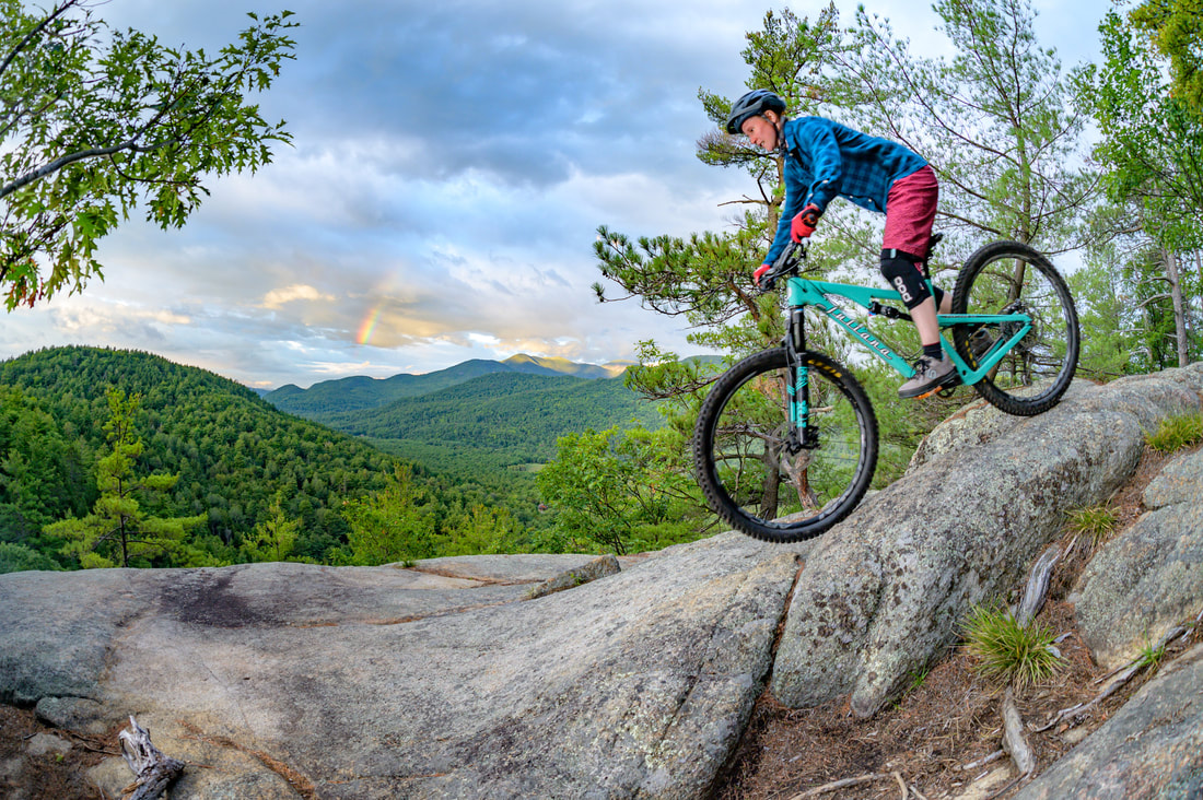
This area consists of over 600 acres of privately owned land and includes several summits, breathtaking views of the Giant Range, a waterfall, and a large heron rookery on the property. The trails range in difficulty from lowland cruisers to technical, challenging climbs, as well as natural and man-made features. Photos: Adsit Media Works (Top) and Roost.
|
Trail Beta
This is a festival site, so you will find many structures in the base area including stages, a lean-to, a bunkhouse and storage buildings on the property. The landowners generously allow use of the property for recreation, but please be respectful and do not enter any of the buildings. Outhouses are available in the base area and may be accessed by trail users.
Check out the map kiosk at the entrance for recommendations to start your adventure. Experienced riders will want to check out BTW, Flowbee, Widowmaker, California and Upper Currey. Beginners will enjoy cruising the Wookie Loop and Lower Currey, and venturing up GBH.
A popular local’s tour of the trails starts at the lean-to (ride through the entrance gate, continue on the dirt road past the main stage until you reach the lean-to). Warm up on the lower Wookie Loop. Then take GBH (starts uphill from the lean-to, enter the woods to climber’s right). Travel the trails in a counterclockwise direction – take GBH to BTW up to the Otis summit, drop down on the upper portion of Flowbee. Look for a right onto Widowmaker which will take you over the second summit to the impressive Heron Rookery. Then take GBX to California, which has an amazing viewpoint perfectly timed for a break before you head over to Upper Currey and return to Otis via the Lower Currey trail.
Weekly group ride meets on Sundays at 9 AM (aka "Dirt Church") inside the gate at the bottom of the first ski hill.
Directions
Approximately 2 miles south of Elizabethtown on Route 9, turn left onto Lobdell Lane. Please drive slowly on this dirt road. Parking area for trail access is just outside the entrance gate at the end of Lobdell Lane. You will see a gate shack with a map kiosk at this parking area.