|
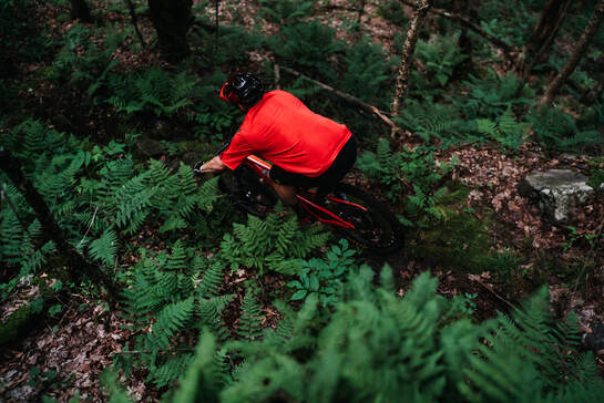
Loggers LOOPSTo add some East Coast old school tech-gnar to your ride, check out the Loggers Loops 1, 2 and 3 which get progressively harder and more technical as you go and Cherry Patch and Broken Dreams. Embrace the roots and they'll embrace you back.
|
TRAIL BETA
There is no right way to stitch these together, BUT to hit all 3 with the option of adding in Broken Dreams and/or Cherry Patch, try cruising in on Loop 1, take a right on Loop 2 (CCW). Some consider this "the hard way" on Loop 2, but riding it in this direction will allow you to return to this intersection after a fast, fun decent. At the end of Loop 2, take a right to head out on 3. Loop 3 is a lollipop, so pick your directional poison. Pedal your way through chunky rocks, interrupted by sections of fast dirt and return back to the Loop 2/3 intersection. Head straight past where you popped out on loop 2 for a fun rip back down. You can catch the entrance to Trail of Broken Dreams on your way or head right back to the intersection of Loop 1/2.
For a bonus challenge, you can hit Cherry Patch off of Loop 3. It drops you back down to route 86, so if you're not interested in hitting some pavement to connect to something else, turn around at the end and buckle up for a brutal climb back up.
Pro Tip: Bring your bug spray. The loops are home to the hungriest mosquitoes in the ADK.
Directions
There are 3 main parking areas for the Lussi & Loggers trail systems. Clockwise from top left on the Trail Map above:
1. Park at the driving range along Rt. 86 just east of the intersection with Rt. 73 (see red pin on map at right). Look for the green kiosk at the bottom of the parking lot where you'll find a map and donation box. This is western end of Cinderella Trail. Parking lot access here is graciously provided by the family that owns the golf course - please be respectful and quiet in the parking lot, stay on marked trails, and stay OFF the golf course at all times.
2. Park at a dirt pull-off along Rt. 86 about 2 miles east of the intersection with Rt. 73. Look for a trail entrance marked with a brown and red sign just uphill from the pull-off. This is beginning of the Stateline Trail.
3. Park along River Rd near the steel deck bridge (not along the private dirt road). Cross the bridge and follow the red Jackrabbit Trail markers to a green kiosk where you'll find a map and donation box. This is also a good place to park to access the Craig Wood trails.